Location: Wānaka, Otago, Aotearoa New Zealand
Project type: Residential subdivision
Delivery/lead organisations: Crescent Investments Ltd; Queenstown Lakes District Council
Date/period: Consent granted 2014; staged development ongoing
Scale: Neighbourhood
Primary system or theme: Stormwater management, open space structure, vegetated reserves
Context
Why this site matters
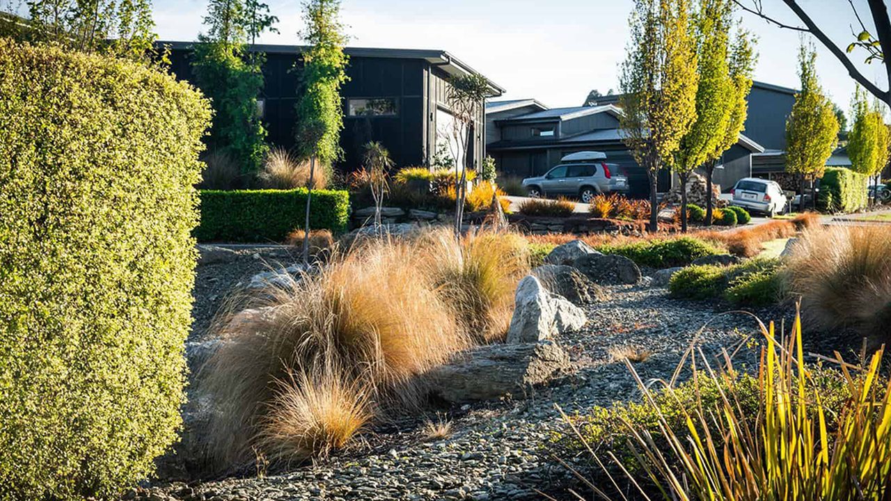
Kirimoko Park is a peri-urban greenfield subdivision developed on gently sloping land with existing drainage gullies. The project is relevant as an example of subdivision design that integrates stormwater and open space with retained landform features, rather than fully engineered regrading. 1
Challenge or constraint
What wasn’t working/what needed to change
Conventional subdivision approaches in similar contexts typically pipe and hard-engineer stormwater, removing natural drainage features and concentrating infrastructure within roads. For Kirimoko Park, subdivision design needed to manage stormwater while accommodating development within gullies and landforms defined through the resource consent process. 1
Intervention
What was done
Stormwater and open space were spatially integrated into the subdivision layout, with natural drainage features retained and incorporated into reserve land. 1, 2
Key components
- Retention of existing gullies as open space and reserve corridors 1
- Alignment of stormwater conveyance and detention with natural drainage paths 2
- Use of vegetated reserves for stormwater management and landscape integration 1, 2
- Preference for native planting within reserve and gully areas, as indicated in project documentation 2
Implementation notes
Design & delivery considerations
- Stormwater infrastructure is accommodated within reserves and road corridors rather than being entirely contained within underground pipe networks 1, 2
- Gully reserves form continuous linear open spaces through the subdivision 1
- Design intent is documented through consent and application materials, not through post-construction ecological monitoring
- Ongoing planting and reserve-care activities are supported in part by community-led initiatives within the wider catchment 3
Outcomes
Observed or reported outcomes
- Retention of natural landform features within the developed subdivision footprint 1
- Delivery of integrated stormwater and open space infrastructure as described in consent and application documentation 1, 2
What is plausible but unmeasured
- Improved surface water management resilience compared to fully piped systems
- Potential for planted gullies to provide limited habitat or movement pathways at a local scale
- Amenity and stewardship benefits associated with vegetated reserves
Evidence & limits
What the evidence supports
Available evidence demonstrates environmentally responsive subdivision design intent, particularly relating to landform retention and integrated stormwater management. 1, 2
Key limitations or uncertainties
- No published post-construction monitoring of water quality or ecological outcomes
- No species surveys or biodiversity performance data
- Outcomes are design-intent-based rather than measured performance
- Transferability depends on site-specific landform, hydrology, and regulatory context
Relevance to design practice
- Integrating stormwater management with retained landforms and open space can reduce reliance on fully engineered systems at the neighbourhood scale
- Do not claim biodiversity or water-quality outcomes without monitoring; design intent alone is insufficient evidence
- This approach is most applicable where natural drainage features can be retained within subdivision layouts and supported through consent conditions and long-term maintenance arrangements
References
- Queenstown Lakes District Council. (2014). Resource consent decision – RM130758 for Kirimoko Park. QLDC.
- Crescent Investments Ltd. (2013). Subdivision and land use consent application – Kirimoko Park, Wānaka. Project documentation.
- WAI Wānaka. (n.d.). Kirimoko Catchment Group. waiwanaka.nz